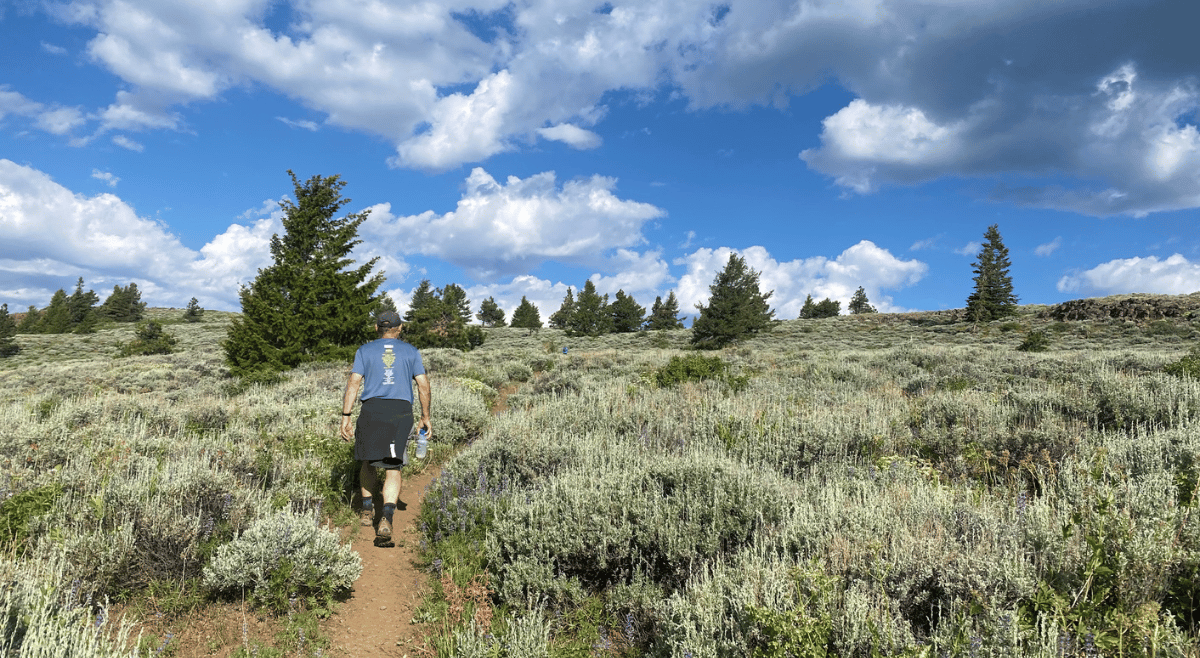
Spring wildflowers trickle like snowmelt from Lookout Mountain. By July, blooms will flood sagebrush meadows in lupine, paintbrush, penstemon, and scarlet gilia. Here, elk shelter within shady fir and pine forests. Pileated woodpeckers drum on life-giving dead trees. Colossal ponderosas grace the lower ridges. Juniper and mountain mahogany sculpt rocky outcrops. Songbirds bustle among leaves of aspen and alder by streams. Hawks, eagles, and ravens draft the shoulder of an open summit.
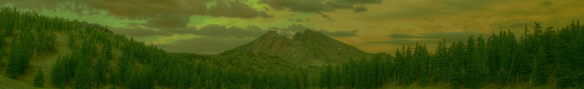
Gatherer of flaming sunsets over the Cascades, Lookout Mountain tops out at almost 7,000 feet, the highest in the Ochoco National Forest, east of Prineville in Central Oregon. Where once a fire lookout stood, the peak is like a beacon shining our attention on the roadless wilds.

In mid-April, I joined two friends for a trek to the top, about a nine-mile round trip from the trailhead at the lower parking area. This was my fifth time hiking the peak, and the first so early in the season. We crossed snowfields muffling meadows. Often, we bushwhacked as we found and lost the snow-covered trail. At the lower elevations, melting snow revealed a labyrinth of raised earthen tunnels, the architecture of voles. We paused to note buttercups with buds tight as fists. By our afternoon return on a sunny day, some buds had burst wide open into five-petaled yellow blooms. That’s the way my heart felt, too.

Lookout is the centerpiece of a more than 1300-square-mile forest at the western edge of the Blue Mountains ecosystem and a critical link to the Cascades. It was here that famous wolf OR-7, named Journey, found safe passage on his thousand-mile-plus trek from northeast Oregon to northern California. The beacon centers our attention, too, on vital wildlife corridors at risk from logging and roading.
The Quest for Wilderness
Forty years ago, the 1984 Oregon Wilderness Act added the first areas on the Ochocos to the national system—Mill Creek, Bridge Creek, and Black Canyon Wilderness. Not including Lookout Mountain’s almost 20,000 roadless acres seemed a puzzling omission.
To find out why, I called Don Tryon, now living in northeast Washington. Tryon was instrumental to the Ochoco’s new Wilderness. At that time, he worked for Oregon Wild (then Oregon Natural Resources Council) out of Prineville. I remember Tryon in the early 1980s as lean, soft-spoken, and at home in the forests he knew intimately from inventorying minerals for the Forest Service in prior years. Tryon’s easy-going manner cloaked an inner tenacity.
“My approach was to get congressional staffers on the ground. We’d pound around and have a good day,” he said. Once, he took Tom Imeson, then an influential aide to Senator Mark Hatfield, on a backpacking trip up Lookout and camped in a beautiful place. He was hopeful.
But later, Imeson told him that four wilderness areas would be too many for the Ochocos. Lookout Mountain, he reasoned, was then a “special management area” for dispersed backcountry recreation. But Wilderness is the gold standard for protection.
Note that today’s Black Canyon, Mill Creek, and Bridge Creek Wilderness tally only 36,200 acres, or four percent of the national forest. Still, adding three new wilderness areas in the Ochocos was a triumph. The Forest Service had recommended just one—Black Canyon.
Every Wilderness has a story of origin. Mill Creek roadless area, the closest to Prineville was not on the Forest Service radar. Tryon, however, knew the terrain well, and steered public attention to the stunning intact forests remaining in the upper watershed.
He recalled one tense moment after Mill Creek had made it into the legislation. A district ranger claimed the boundaries should be reduced after returning from a horseback field survey. Tryon met with the ranger and the forest supervisor and pulled out the map. The supervisor sided with Tryon after a close inspection of the drawn lines. The bill went forward with the correct map intact. Mill Creek Wilderness is the largest of the three at 17,000 acres.
When Tryon led Imeson and other congressional aides into Bridge Creek, a golden eagle soared and circled right overhead—as if on cue. There was no question this 5,400 acres of meadows, plateaus, springs, and forests of fir, larch, and lodgepole would be in the final bill.
I love it when nature bats for Wilderness.

Campaign: Ochoco Mountains National Recreation Area
Lookout Mountain’s wild beacon shone bright from 2014 to 2016 when Oregon Wild led a campaign for an Ochoco Mountains National Recreation Area –inspired as one way to honor the legacy of Oregon Wild’s Tim Lillebo. He had long defended the ancient forests of the Ochocos and was instrumental in the 1994 East Side Screens protecting trees 21 inches in diameter and larger (recently reinstated in a court victory).
If enacted by Congress, the national recreation area would enfold about 300,000 acres and include wilderness protections for 26,000 acres. Timing is everything. A win seemed on the horizon. Who would have predicted that the proposal would coincide with the violent takeover of the Malheur National Wildlife Refuge in early 2016?
Many of those extremists traveled more than two hours to Prineville to heckle and jeer at one terrifying public meeting at the Crook County Fairgrounds. They sabotaged a grassroots effort that epitomized local cooperation--finding common ground, compromise, and goodwill.
It was youthful Sarah Cuddy, then the Ochoco campaign organizer for Oregon Wild, who stood up without flinching in front of 600-plus people who were there to bully. Her bravery awed fellow environmentalists who attended, including Erik Fernandez of Oregon Wild, Amy Stuart of the Bitterbrush Chapter of the Great Old Broads for Wilderness, and Mathieu Federspiel of the Juniper Group of the Oregon Sierra Club. (All of them continue to advocate for the Ochoco wilds today.)
Police offered to escort Cuddy out for her safety, but she declined. After all, she was from Prineville. This was her home. She held her head high and was unafraid.

Sarah Cuddy. Photo by Joel Caldwell
Today, Cuddy lives in Baker City, working as a regional coordinator for Oregon’s Outdoor Schools. We serve together on the Board of the Greater Hells Canyon Council. At an April retreat, I sat down with her to learn more.
She had planned four meetings on different topics to gather ideas for the proposal that many local people had helped shape. The first two meetings went smoothly, she said, with about 40 people attending each. Then, the winds shifted for the worse. Looking back, Cuddy wished she had canceled the next two. In a local election fueled by the Malheur takeover, a candidate for the judge position used his anti-public lands stance as his platform. He won the election and fueled local distrust for the proposal that had not been present before.
That distrust culminated at the fairgrounds in late January of 2016. It was there that Cuddy stood up with a message of locals caring for the Ochocos. She spoke of coming of age in this forest and her hometown of Prineville. She learned to flyfish on tiny streams, camped at Walton Lake, and often climbed both Lookout and nearby Round Mountain with her family. “But people weren’t listening,” she said. “They were a hundred percent about the Malheur occupation. It was sad. You felt this positive community-supported vision taking root and then completely crumpling.”
Before the Malheur takeover, Cuddy said there was a feeling of unity. Then, two Crook County Commissioners listened to Oregon Wild with open minds and were intrigued by a proactive protection plan for the Ochocos. Many locals felt the Ochocos were changing for the worse. What brought them together was a Forest Service proposal to build a huge network of Off Highway Vehicle (OHV) trails. Nearby landowners, hunters, anglers, horseback riders, hikers, and mountain bikers hated the OHV plan, she said. (Ultimately the unpopular Forest Service scheme to add 137 miles of OHV trails through old-growth forest was defeated in district court in 2019.)
The challenge was to merge multiple visions for the future. Cuddy rolled up her sleeves, researching the Sawtooth and Hells Canyon National Recreation Areas. Both offered solutions and pitfalls. The resulting proposal benefited from Cuddy’s ability to bring people to the table over tough issues, including livestock grazing, logging, and closing roads to give wildlife shelter. Like others participating, Oregon Wild had certain “must haves” in the proposal, including protecting roadless areas and designating more wilderness. “There are very few places on the Ochoco where roads don’t exist,” said Cuddy. It remains imperative that the remaining roadless areas remain roadless.”
For historical perspective, in 2001 the Forest Service issued the Roadless Area Conservation Rule after 600 public hearings. Designed to protect 58.5 million acres of vital wildlands from roading and logging, the rule includes 2 million acres in Oregon. However, the Forest Service inventoried only roadless lands of 5,000 acres and larger. That leaves the smaller roadless areas highly vulnerable. Lookout Mountain is 14,000 acres according to the inventoried roadless area, but 20,000 acres reflects the actual size. Even the inventoried areas are at risk as administrations change.
To keep roadless areas roadless takes vigilance. Right now, a Forest Service proposed Mill Creek Dry Forest Restoration Project covering more than 23, 000 acres would log in the Stein’s Pillar citizen-inventoried roadless area. Oregon Wild and several other environmental groups watchdogging the Ochocos filed objections on multiple issues.
Meanwhile, Oregon Wild and others are supporting other protections for the area: three streams that flow from its plateau are proposed for wild and scenic river protection in the River Democracy Act – Canyon Creek, Brush Creek, and Lookout Creek.
And the Ochoco Mountains National Recreation Area proposal remains—ready to be taken up when the time is right. It would include roadless additions to the National Wilderness System: the east side of Lookout Mountain (reduced as a compromise with mountain bikers), Spanish Peak, and an expansion of Black Canyon Wilderness to include Rock Creek.
“People think if roadless areas are small, they are not important, but you have to take what’s remaining and grow the wilds,” Cuddy said, pointing to the significance of intact landscapes as headwater protectors, and wildlife havens and corridors in a time of drastic climate change. Those wild places are rare in the Ochocos, where about only 7 percent of the forest is beyond a half-mile from a road.
We ended our conversation on a note of optimism for the proposal that reminded me of the famous words of Martin Luther King: “We shall overcome because the arc of the moral universe is long but it bends toward justice.”
Lookout Mountain is Calling…

Lookout Mountain is one special place. Gently ascending trails pass through many of the 28 plant communities and the largest remaining old-growth forests in the Ochocos. Nature is rewilding the old Mother Lode Mine not far from the upper trailhead. A rustic wood shelter tucked in trees off the summit is barely noticeable. Present, too, are the invisible footsteps of indigenous peoples over 10,000 years or more. Central Oregon is part of the ancestral lands of the Wasco, Tenino, and Northern Paiute Tribes.
As the east side Cascades become crowded, more recreationists are discovering Lookout Mountain for hiking, trail running, mountain biking, and horseback riding. In turn, this wild beacon calls all who clamber up her sides to treat her well. Go lightly. Do not take her for granted. Be part of a legacy of preservation. Each one of us has the power to make a difference. All the wild Ochocos are calling on us to engage on behalf of threatened wilds in this 50th anniversary year of Oregon Wild and the 60th anniversary of the 1964 Wilderness Act. Take heart from wildflower buds opening brilliant petals to the sun.
Take a Hike!
- Lookout Mountain and Mill Creek Wilderness are featured hikes within Oregon’s Ancient Forests: A Hiking Guide, by Chandra LeGue of Oregon Wild.
More Resources
- Marina Richie’s 2021 blog, “Let’s Keep it Wild—Lookout Mountain in the Ochocos.”
- Andy Kerr’s book, Oregon Wild, Endangered Forest Wilderness, includes a detailed map for a proposed Ochoco Mountains Wilderness adding 110,192 acres of new Wilderness. It’s a great way to find the unprotected roadless areas—get to know them and keep them wild!
Acknowledgements
While I was not able to include many stories I learned for this piece, I appreciate the interviews with Don Tryon, Tonia Wolf, Sarah Cuddy, Mathieu Federspiel, and Amy Stuart. When researching wilderness in the Ochocos I found Jenna Deibel’s 2023 master’s thesis on baseline monitoring of the existing wilderness areas. In conversation, she shared some of her detailed notes from her interview with Don Tryon on wilderness origins that supplemented my conversation with him. In her thesis, she recommended the Ochocos designate a wilderness ranger. Kudos to the Forest Service for filling that position.