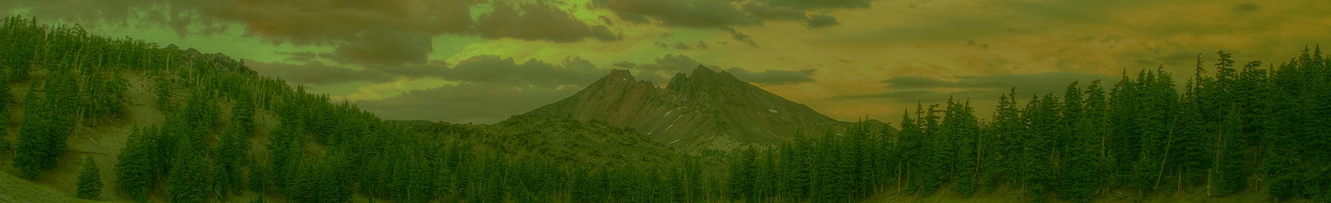
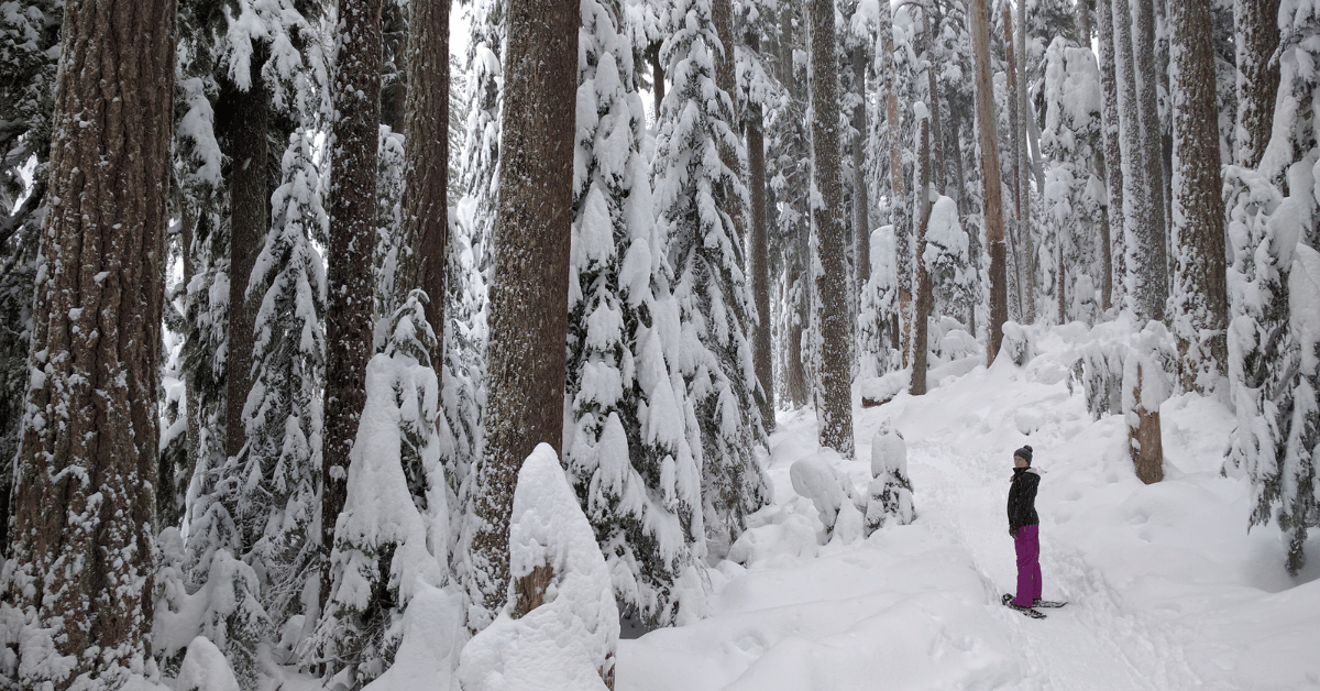
Even though many of our favorite hiking trails are covered in snow, winter is still a great time to get out and enjoy Oregon’s wild places. From the iconic Crater Lake National Park to the well-maintained trail systems outside of Bend, the state offers a plethora of breathtaking snowshoeing destinations. In this blog post, we'll guide you through five places to strap on your snowshoes and embark on a winter adventure through Oregon’s public lands.
If you are new to snowshoeing, or looking to learn about other snowshoeing destinations in Oregon, check out our webcasts on snowshoeing central Oregon and snowshoeing Mt. Hood.
All the trails in this article follow streams that would be protected as Wild & Scenic under Senator Ron Wyden’s River Democracy Act. We may generally think of Wild & Scenic Rivers as summer destinations, but they can be just as–if not more–enchanting in the winter (with a fraction of the people!). These streams offer year-round recreation for Oregonians and visitors alike, and the River Democracy Act offers an incredible opportunity to protect these treasures for the invaluable benefits they provide to us and wildlife. Join Oregon Wild in supporting the passage of the River Democracy Act.
Jump to
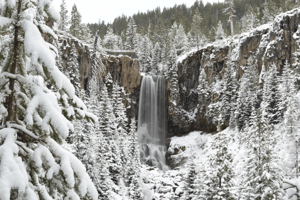
Tumalo Creek Falls
Located just outside of Bend, Tumalo Falls is one of central Oregon’s most visited destinations in the summer. In the winter, the out-and-back trail from Skyliner Sno-Park provides a perfect snowshoeing experience through a snow-laden forest alongside Tumalo Creek, with the reward of witnessing the majestic 97-foot waterfall framed by ice and snow.
In addition to being home to one of the most scenic waterfalls in the area, the Tumalo Creek watershed also supplies clean drinking water to over 100,000 people in the city of Bend. The River Democracy Act would safeguard this local favorite for its water quality, scenic beauty, important wildlife habitat, and incredible recreation opportunities.
- Distance: 6 miles roundtrip
- Difficulty: Moderate
- How to get there: From Bend, travel west about 10 miles until you reach Skyliner Sno-Park. Follow the Tumalo Creek Trail west for about 3 miles until you reach the Falls. Alternatively, you can make it a loop by hiking back along the snow-covered road on the north side of Tumalo Creek.
- Recreation passes/fees: Sno-Park pass
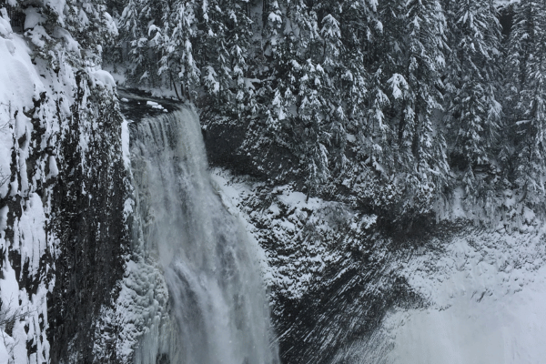
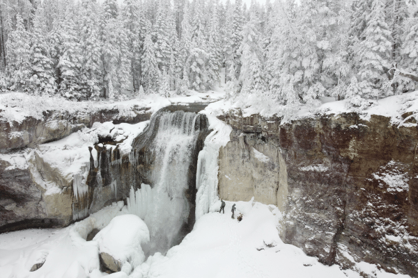
Salt Creek Falls
Situated just off State Highway 58 in the Willamette National Forest, Oregon’s second-highest waterfall–Salt Creek Falls– transforms into a mesmerizing icy spectacle during the winter months. The short Salt Creek Falls Trail offers stunning views of the 286-foot waterfall and includes observation areas at the top and bottom of the falls, providing ample photo opportunities along the way.
For a longer loop hike, follow Salt Creek upstream until you reach the Diamond Creek Falls Trail, which takes snowshoers through a tranquil old-growth forest and provides viewpoints of Diamond Creek Falls and Salt Creek. Make sure to follow the trail markers (they look like blue diamonds), as route-finding can be more difficult when the trail is covered in snow. Read our blog post on snowshoeing at Salt Creek Falls and Diamond Creek Falls for more information about this snowshoe hike.
The River Democracy Act would protect over 14 miles of Salt Creek–including the falls–as Wild & Scenic, protecting the area for future generations to enjoy.
- Distance: About 1-mile roundtrip to Salt Creek Falls; 4.5 miles for the Diamond Creek Falls loop
- Difficulty: Moderate-Difficult
- How to get there: From Eugene, follow Highway 58 southeast through the town of Oakridge. Go another 23 miles, and about a mile past the tunnel, at mile post 57 and a sign for the Sno Park, turn right. Then turn left to cross a bridge and continue to the parking area, where you’ll find a vault toilet.
- Recreation passes/fees: Sno-Park pass
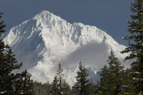
Lost Creek/Old Maid Flat (Mount Hood)
As one of the most iconic peaks in the Pacific Northwest, Mount Hood transforms into a snowy playground during the winter months. Numerous sno-parks and trails in the area cater to snowshoers of varying skill levels. The scenic beauty, combined with the thrill of exploring the snow-covered slopes, makes Mount Hood a prime destination for winter adventurers.
One of the more off-the-beaten-path snowshoeing destinations in the area is Old Maid Flat in the Wild & Scenic Sandy River drainage. Lost Creek, a tributary of the Sandy River, would be protected as part of the River Democracy Act. This trail offers scenic views of the creek at the beginning and spectacular views of Mt. Hood along the way as Oregon’s tallest peak towers over the surrounding forest. This relatively easy snowshoe trail eventually becomes steep and difficult, and a nice turnaround point is just below the switchback where the Horseshoe Trail turns uphill and east. Make sure to bring a map and GPS to guide you as the trails and roads here are not well marked when covered in snow.
Lost Creek and nearby Clear Fork are both included in the River Democracy Act.
- Distance: About 3 miles roundtrip
- Difficulty: Easy-Moderate
- How to get there: From Highway 26 in Zigzag, turn north onto Lolo Pass Road and drive 4.5 miles to the sign for the Mt. Hood National Forest; turn right toward Ramona Falls and park where the plowing ends (this can vary sometimes depending on recent snowfall). Snowshoe on the snow-covered roads until you get to the Horseshoe Trailhead and head up the Horseshoe trail as far as you like. Lolo Pass road is not always plowed as quickly right after a storm, so you might want to give it a day or two before heading up after a big snow.
- Recreation passes/fees: None
Paulina Creek Falls
Nestled in Newberry National Volcanic Monument, Paulina Falls is a captivating winter destination for snowshoe enthusiasts. The Paulina Creek Falls Trail takes you through a serene forest, offering glimpses of the icy Paulina Creek and leading to the breathtaking viewpoint of the falls. When the falls are frozen over after several days of cold temperatures, it also becomes a popular ice-climbing destination!
Follow the trail a little further past the falls to reach the outlet of Paulina Lake and enjoy the scenic splendor of a volcanic caldera turned winter wonderland. On weekends in the winter, the Paulina Lake Lodge restaurant is open to thaw you out with a hot drink or warm meal. Be wary of nearby snowmobiles.
Over 8 miles of Paulina Creek, from its source at Paulina Lake to near its confluence with the Little Deschutes River, would be protected by the River Democracy Act.
- Distance: About 7 miles roundtrip to Paulina Lake and back
- Difficulty: Moderate-Difficult
- Parking: 10 mile Sno-Park
- Recreation passes/fees: Sno-Park pass
Hackleman Creek
For those seeking a quiet and secluded snowshoeing experience, Hackleman Creek offers a hidden gem in the Willamette National Forest. The Hackleman Old Growth Trail, accessible year-round, takes hikers through an enchanting old-growth forest of ancient Douglas fir giants and western red cedar. The peaceful ambiance, combined with the pristine beauty of the snow-covered landscape, creates a magical setting for winter exploration.
While this trail is right off the highway, use extra caution in route-finding as the trail and trail markers may be completely hidden under the snow. However, even while taking care to follow the trail, don’t forget to look at the expansive canopy of the forest above.
The entire 7 miles of Hackleman Creek (and the surrounding old-growth forest) would be protected under the River Democracy Act. Despite its small size, the Hackleman drainage is home to an impressive array of biological diversity, including the Hackleman trout–a subspecies of cutthroat trout that only survives in this creek. Learn more about this unique and special watershed here.
- Distance: 1 mile
- Difficulty: Easy-Moderate
- How to get there: Park just off the highway at the Hackleman Old Growth Grove Trailhead, about 2.5 miles east of Tombstone Pass on Highway 20.
- Recreation passes/fees: none
Snowshoeing is one of the easiest and safest ways to get out and enjoy Oregon’s public lands in winter. Even if you have hiked these areas in the summer, visiting in the winter can provide a whole new perspective! However, there are still hazards to watch out for while snowshoeing. Here are some tips to keep in mind:
- Winter weather can be unpredictable! Be sure to check weather and road conditions (tripcheck.com) before heading out, and be prepared with snow tires, chains, and emergency gear if necessary.
- Carry the 10 Essentials for Hiking (the winter version: add extra layers, hot cocoa, and extra warm gloves!)
- You may be surprised at how warm you get while snowshoeing, bring plenty of warm clothing, but layer accordingly so you can remove some when necessary. Try to avoid getting sweaty as wet clothing can lead to hypothermia.
- View our recent webcast for more tips on snowshoeing gear, planning, and safety.
Tumalo Creek Falls: Samantha Saville
Salt Creek Falls: Chandra LeGue
Mt. Hood from Lost Creek: Erik Fernandez
Paulina Creek Falls: Michael Grass